Mapping Marriage and Migration in Emancipation-era Virginia
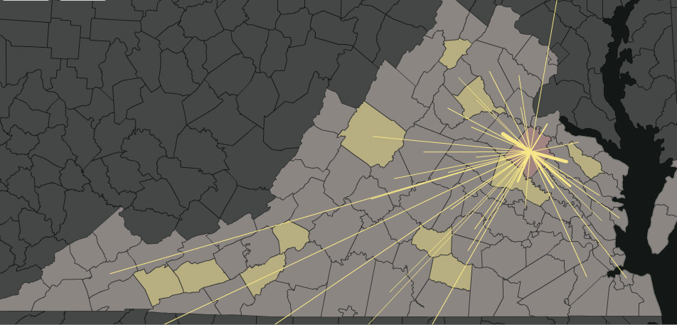
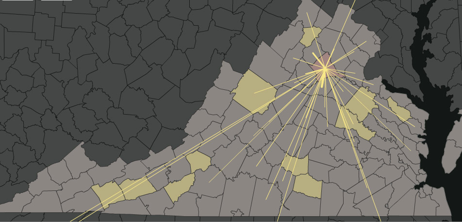
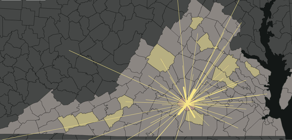
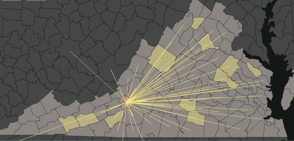
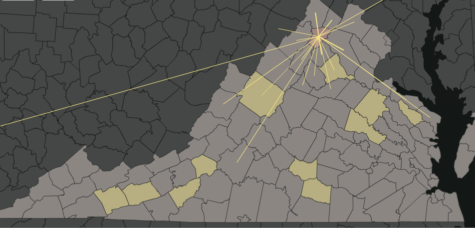
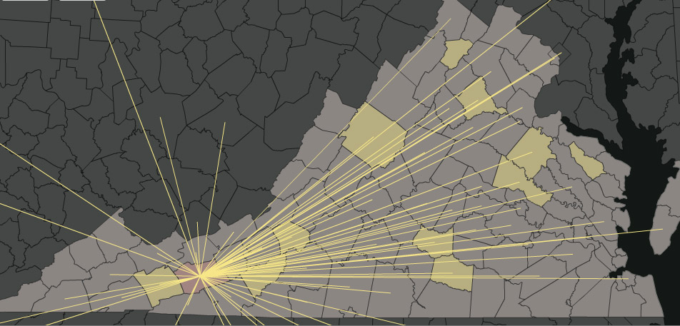
This series of images is taken from an online mapping application built as part of "Scales Intimate and Sprawling: Slavery, Emancipation, and the Geography of Marriage in Virginia," published by Southern Spaces. They show the migrations of African American men and women who were forming marriages in Virginia in the immediate aftermath of slavery. Postwar families were formed at the most intimate scale of the household; they were also products of longer migrations, whose patterns varied from county to county and were shaped by the domestic slave trade. Highlighted counties are those for which we have data. The migration lines connect the birthplaces of African American men and women with the counties in which they were married. Producing these images has been a collaborative project from the beginning, and we would especially like to thank those who have done significant work tracking down and transcribing these sources, especially the Black History Museum and Cultural Center of Virginia and the Virginia Memory project of the Library of Virginia.
Augusta
Caroline
Culpeper

Floyd

Hanover

Lunenburg
Prince Edward

Richmond
Roanoke

Smyth
Warren
Wythe