Atlas of the Historical Geography of the United States
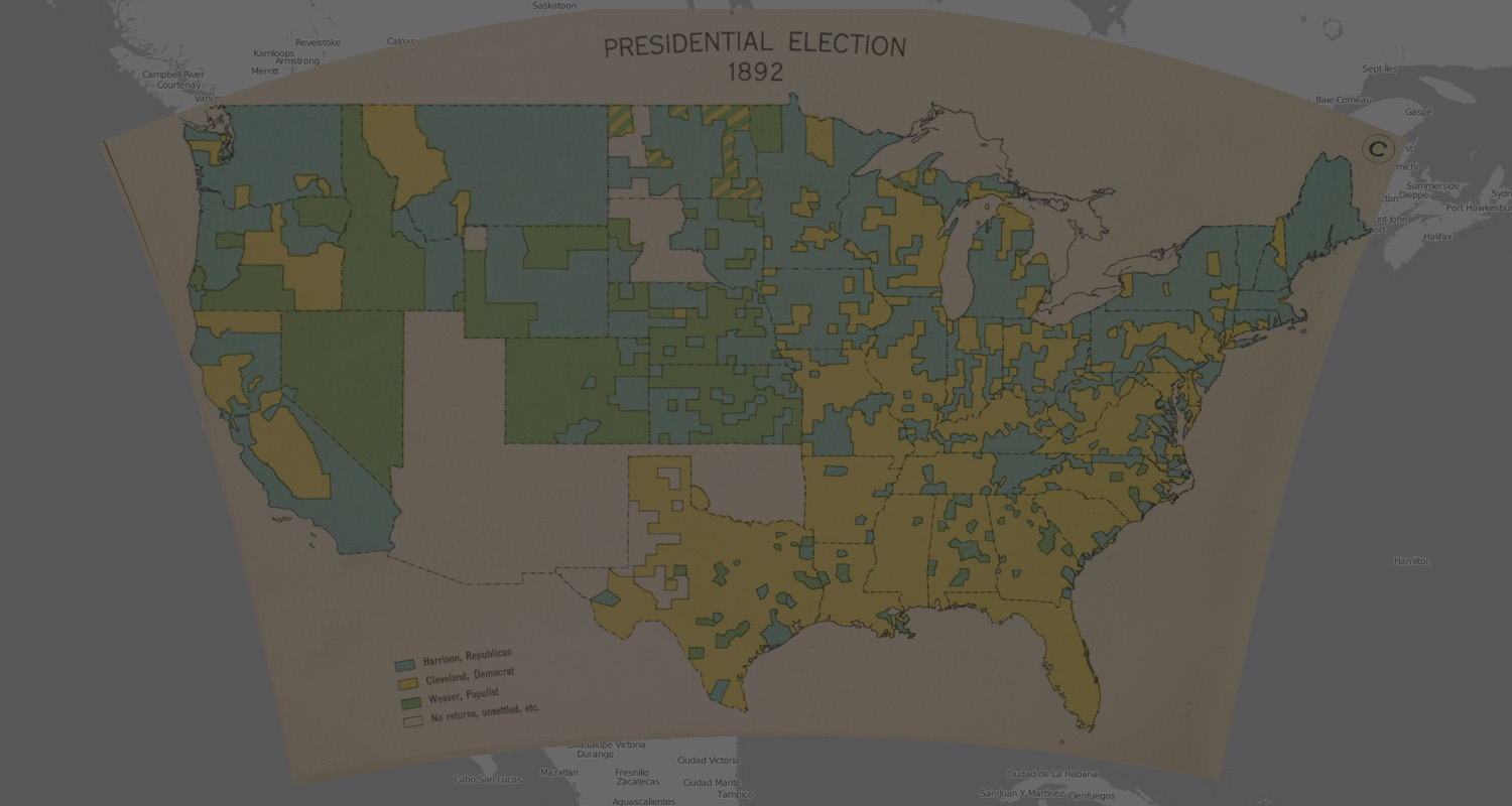
Explore moments where third-party candidates affected the outcome of presidential elections.
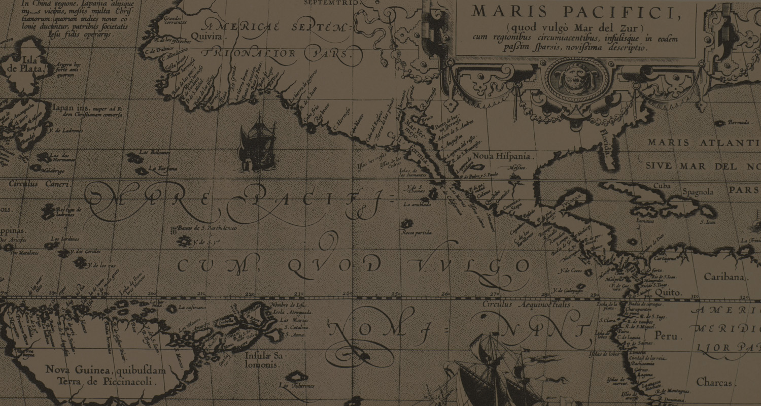
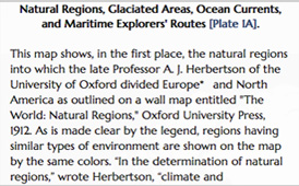
See the growing cartographic knowledge of North America.
Are we there yet? Travel time
Explore the early mechanization of American agriculture.
Atlas of the Historical Geography of the United States
scroll down
A spectacular historical atlas refashioned for the 21st century
Here you will find one of the greatest historical atlases: Charles O. Paullin and John K. Wright's Atlas of the Historical Geography of the United States, first published in 1932. This digital edition reproduces all of the atlas's nearly 700 maps. Many of these beautiful maps are enhanced here in ways impossible in print, animated to show change over time or made clickable to view the underlying data—remarkable maps produced eight decades ago with the functionality of the twenty-first century.
hide introductory video
next
Old Atlas, New Functionality
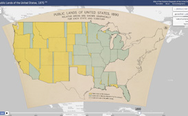
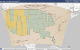
Georectified Maps
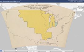
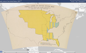
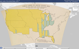
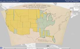
Most maps in the atlas have been georectified, warped so that they can be placed consistently on top of a digital map.
For most maps in the atlas click on georectified ⇆ plate to toggle back and forth between views of the georectified maps and how they look in the printed atlas.
There are lots of maps in the Atlas. Open up the table of contents to find what you're looking for among the atlas's 14 chapters and nearly 700 maps.
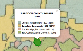
If you want to know more about a map, open up the text to read more about the sources on which it was based.